
Weather Headlines
- NEXT 9 HOURS: First batch tonight
- SHORT TERM: Second round later Friday
- LONG TERM: Temperature swings
Latest Forecast
CEDAR RAPIDS, Iowa (KCRG) – Two rounds of activity look likely for eastern Iowa with a storm system moving through.
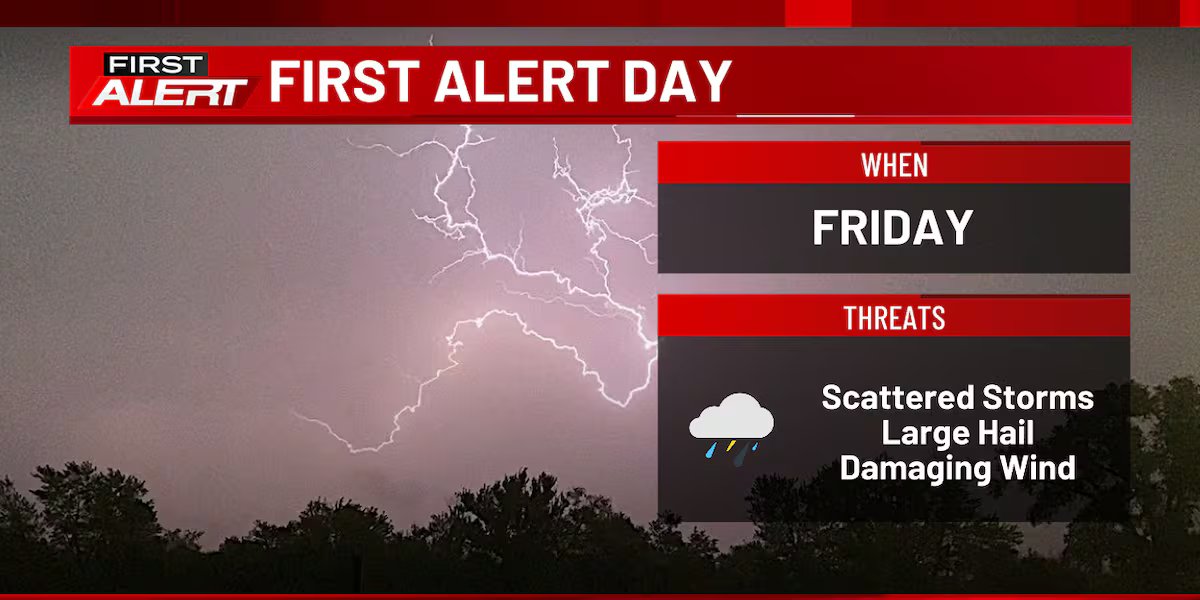
Because of the threat of storms that could turn strong to severe, Friday is a First Alert Day.
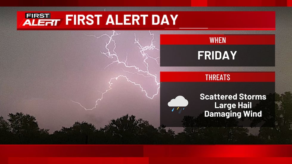
The first will take shape later tonight. After an evening of dry and mild conditions, we’ll see a push of warmer, more humid, and more unstable air into eastern Iowa. This will result in the development of thunderstorms near or after midnight, pushing northeastward after that. Heavy downpours and frequent lightning are likely with any storm. There’s also the slim chance for a storm to be strong enough to produce some hail, perhaps approaching quarter-sized in a case or two.

(KCRG)
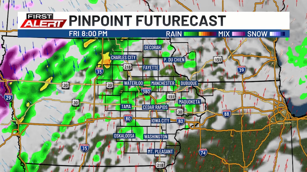
This activity is most likely between 3:00 a.m. in the west, to around 8:00 a.m. in the east. Lingering showers and storms could hold on as late as early afternoon on Friday, though there will be a trend toward drier weather for a period of time during the day.
While that happens, some unstable air will build into the region, providing additional energy for new storm development later on Friday. While the amount of energy will be relatively modest, given the time of day and time of year, it should be sufficient to keep the risk for strong to severe storms going.
The next round develops in central and western Iowa by mid-evening, with new storms spreading into eastern Iowa by between 7:00 to 9:00 p.m. There’s a hint in the latest data we use to help make our forecasts that areas near and north of U.S. Highway 30 could be initially favored for the strongest storms during the evening. Damaging wind, large hail, and even an isolated tornado will be possible.
How things evolve later in the evening into the early overnight hours will determine how long the severe weather threat lasts. If an organized line of storms forms ahead of the cold front moving through the region, the chance for damaging winds could last until around 1:00 to 3:00 a.m. on early Saturday morning. After that time frame, the front should clear the area, leaving behind a stabilizing situation.
If a storm approaches your area, seek shelter indoors. If a warning is issued, get to the lowest floor of your home, away from windows. In the event of a tornado warning, put as many walls between you and the outside as possible, like in an interior closet or bathroom. A basement is best if you have one. Cover your head and neck with pillows or blankets, or a bike helmet if you have one. If you’re in a mobile home, abandon it for more substantial shelter. If caught outdoors, try to get to an indoor shelter. As a last resort, lay flat in a ditch while protecting your head and neck. Don’t seek shelter under bridges or overpasses.
It’s important to make sure to have multiple ways to receive warnings. A NOAA Weather Radio is a great tool in this case. Make sure it’s plugged in and turned on, ready to receive warnings, before you head to bed. We also recommend the KCRG-TV9 First Alert Weather App, which can give you customized alerts for your location. Of course, we’ll also provide updates on KCRG.com and KCRG-TV9 as conditions warrant.
Blustery west and northwest winds kick in behind the front late tonight, driving temperatures down into the upper 30s north to mid 40s south by daybreak on Saturday. Temperatures will then struggle the rest of the day, only bouncing back into the mid to upper 40s at best by the afternoon. Skies will clear out, though, and should stay mostly sunny during the day.
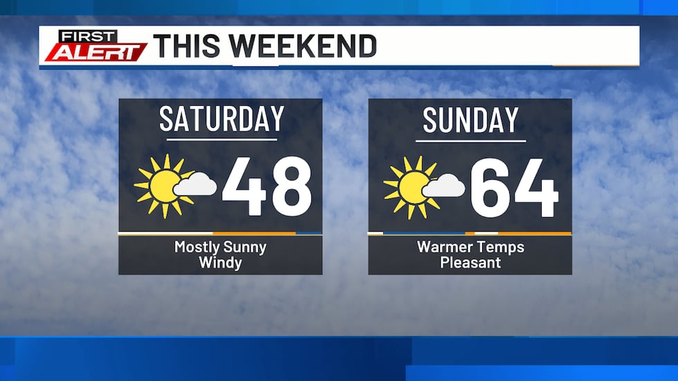
Sunshine will be a common theme for the weekend, though the weather will be quite a bit different between Saturday and Sunday. Temperatures will begin warming again, with highs on Sunday back into the 60s for most. A southerly or southwesterly wind will help this warm up.
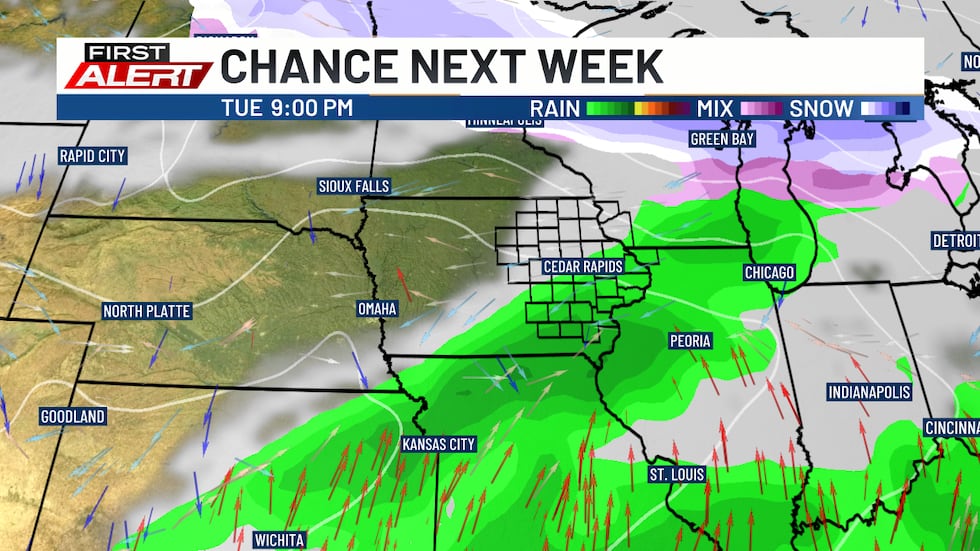
We’ll keep the trend going into Monday and Tuesday next week, with a couple of more days in the upper 60s to low 70s likely. This is ahead of another storm system that will bring another precipitation chance to the area. Showers and storms will be possible Tuesday into Tuesday night.
As colder air returns behind this system, a little bit of a mix of rain and snow could materialize on Wednesday. However, this chance has been dwindling in the latest data we have. Hopefully, we can avoid significant wintry impacts as a result.
Temperatures will only be in the 40s for the middle of next week, bouncing back toward the 50s by the start of the following weekend.
Copyright 2026 KCRG. All rights reserved.