
Gusty winds linger into Tuesday with a few snow showers. We return to the deep freeze to start 2026.Wind and Winter AlertsA Wind Advisory is up for all of Western PA along with Monongalia and Preston Counties. A High Wind Warning is up for Garrett County. Both alerts go until 1 a.m. Tuesday. Wind gusts could reach 50 mph. For Garrett County, wind gusts could reach 65 mph.A Winter Weather Advisory is up for Clarion, Forest, Venango, Preston, Garrett, and the higher elevations of Indiana, Westmoreland, Fayette, and Monongalia counties. Snow from Monday morning through Tuesday morning.Impact Days: Gusty Winds, snow showers, and single-digit wind chillsTemperatures will remain cold on Tuesday and through the weekend. We will not make it out of the 20s on Tuesday. We will not break the freezing mark through the weekend. There is an impact day on Tuesday for windy conditions and an impact day on Wednesday for snow showers. Weather outlook for the New Year More light snow showers will set up late on New Year’s Eve into New Year’s Day, with the potential for snow to fall during First Night. The cold air with highs near freezing will extend through the early days of January. TUESDAY – Impact Day: Breezy with snow showers in the morning. High: 28°, low: 22°.WEDNESDAY/NEW YEAR’S EVE – Impact Day: A few snow showers early, then Cloudy and cold with snow showers late. High: 31°, low: 15°.THURSDAY/NEW YEAR’S DAY: Cloudy and cold with PM snow showers. High: 24°, low: 14°.
Gusty winds linger into Tuesday with a few snow showers. We return to the deep freeze to start 2026.
Wind and Winter Alerts
A Wind Advisory is up for all of Western PA along with Monongalia and Preston Counties. A High Wind Warning is up for Garrett County. Both alerts go until 1 a.m. Tuesday. Wind gusts could reach 50 mph. For Garrett County, wind gusts could reach 65 mph.

A Winter Weather Advisory is up for Clarion, Forest, Venango, Preston, Garrett, and the higher elevations of Indiana, Westmoreland, Fayette, and Monongalia counties. Snow from Monday morning through Tuesday morning.

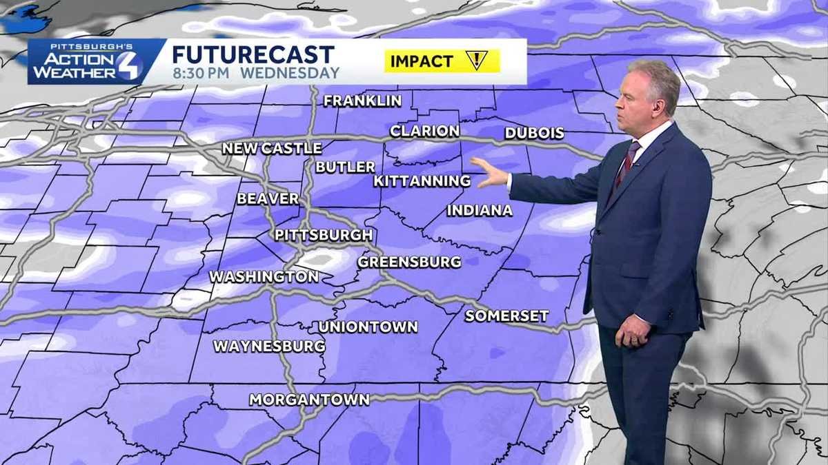
Impact Days: Gusty Winds, snow showers, and single-digit wind chills
Temperatures will remain cold on Tuesday and through the weekend. We will not make it out of the 20s on Tuesday. We will not break the freezing mark through the weekend. There is an impact day on Tuesday for windy conditions and an impact day on Wednesday for snow showers.

Weather outlook for the New Year
More light snow showers will set up late on New Year’s Eve into New Year’s Day, with the potential for snow to fall during First Night. The cold air with highs near freezing will extend through the early days of January.

TUESDAY – Impact Day: Breezy with snow showers in the morning. High: 28°, low: 22°.
WEDNESDAY/NEW YEAR’S EVE – Impact Day: A few snow showers early, then Cloudy and cold with snow showers late. High: 31°, low: 15°.
THURSDAY/NEW YEAR’S DAY: Cloudy and cold with PM snow showers. High: 24°, low: 14°.